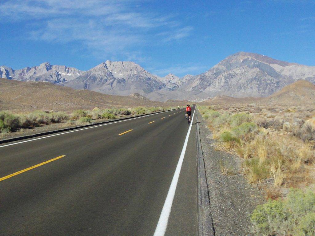
The Owens Valley is a remarkable place in what feels like the middle of nowhere–east of the Sierra Nevada Mountains and west of the White Mountains, about 200 miles south of Reno and 270 miles north of Las Vegas. The valley floor lies at about 4,000′ elevation with paved roads leading out of it that top out above 10,000′. The Owens Valley is in the rain shadow of the Sierra, and the landscape is dominated by sagebrush and expansive views.
The plan was to cycle “the best” of these roads, which can dish up over 6,000′ of climbing in a single serving.
The idea for an Owens Valley expedition gained momentum last Spring with an email thread about the now defunct Everest Challenge Stage Race, which claimed to be the hardest two day stage race on the USA Cycling calendar. It had three monumental climbs each day and a total elevation gain of 29,035 feet in 206 miles.
Tom Meloy did most of the planning. He referenced John Summerson’s “The Complete Guide to Climbing (By Bike),” and Bill Oetinger’s posts about rides in the Eastern Sierra. Tom also took a look at Cycling Escapes, which appears to be the only commercial outfit that rides in this area.
It was a solid 16 hour drive, about 1000 miles, from Seattle to Bishop, CA. Once in the valley, we stayed in motels in Bishop and Lone Pine where we recovered after each day’s effort. The return trip took two days and we stayed at Klamath Falls as a mid-way point.
The original menu consisted of 2 climbs per day that would total roughly 10K of climbing. But, the first day was a reality check and we dialed back our objectives. The consistent steepness of the climbs combined with the high elevation make these extraordinarily difficult one-day rides, but when combined back-to-back we realized that we needed time to recover in order to be able to ride 6 days straight. Instead of two climbs we (mostly) did one per day, and were usually back in town no later than mid-afternoon with plenty of time to eat, hydrate, and recover.
In general, these rides involve 1.5-3 hours of very strenuous uphill effort, and most of the climbs finish near or above 10,000′ elevation. Miles and miles of 7-10% grades are standard, but 11-15% is not uncommon and some of the climbs have extended pitches of 15%+. I consistently got a hacking cough above 8,500′ as a result of the strenuous effort. Another facet of these rides is that they are all out-and-back up dead end roads. The Garmin data listed below are for the entire rides, but the actual climbing is generally confined to about half those distances. So for example, the Whitney Portal ride climbs 4,522 ft in ~12 miles.
Prior to this outing I never really paid much attention to the percentage grade of climbs–I just kept a loose mental categorization ranging from “not so hard” to “out of the saddle and barely moving forward.” I didn’t really keep track of how it felt to ride, say, a 10% grade. During this trip I found it useful to know the percentage grade of whatever I was climbing, and I now have a kinesthetic understanding of what it feels like to climb a particular grade for an extended period of time. A Garmin 500 enabled me to track feet climbed per hour, and once I got the hang of how fast I could sustainably ride a given steepness I was able to estimate how much suffering remained and monitor my effort accordingly.
Sherwin Grade and Rock Creek Rd.
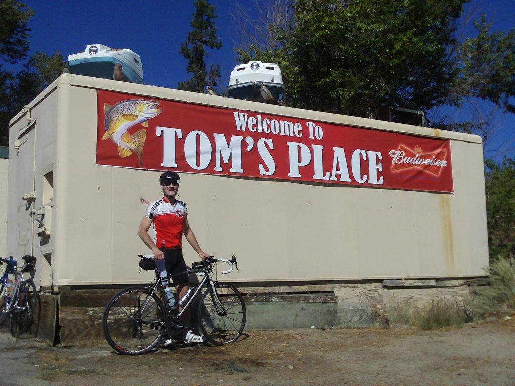
This route has a benign, gradual start along a wooded creek that eventually leads up to the highest paved road in California at 10,220′. After climbing the Sherwin Grade there is a ~300′ descent, then a steady climb for the rest of the ride, including a short stretch on Hwy 395. We found a water spigot at the market at Tom’s Place–a small resort just west of Hwy 395.
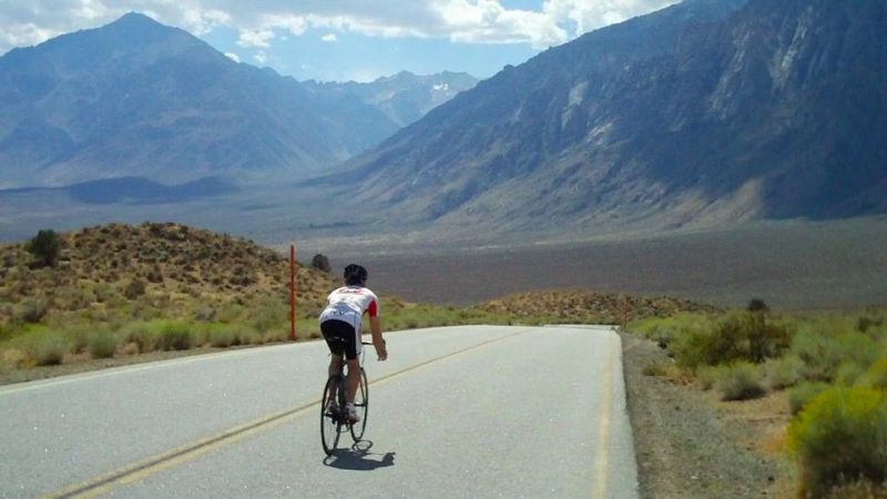
Although Rock Creek has the cachet of being the highest paved road in California, the scenery is relatively unremarkable, though we did enjoy the fall Aspen color. Meanwhile, the descent down the Sherwin Grade IS spectacular, with an imposing view of the Sierra as a backdrop.
Bishop to South Lake and Lake Sabrina
On this route we combined two climbs into a “Y” shaped loop. After pedaling a few flat miles west of Bishop, the road tips upward and is a steady 8% grade most of the way, except at the very end where there are some very steep sections just before the finish parking lots. We did the hardest first–South Lake–then pedaled over to Lake Sabrina. Both lakes sit in scenic granite cirques below towering peaks. The straightaway descent back to Bishop is very fast and Tom hit over 50 mph. There were plenty of places to get water near both lakes.
Video: Rock Creek and South/Sabrina Lakes
Big Pine to White Mtn. (aka Bristlecone)
Tom and I agreed without question that this was the toughest climb of the week. This was the only ride that leads out of the east side of the Owens Valley. After a few flat miles, the road weaves up a small valley that isn’t discernible from the start in Big Pine. Although the average grade is supposedly a mere 6%, the lower section along Hwy 168 includes a number of 9-12% rollers, with a maximum grade of 14%. The maximum grade on the upper section of White Mtn. Rd is 17%, and the final 3 miles, as you pass through 10,000′ elevation, averages a 10% grade. What makes this ride particularly difficult are the ups and downs. The body adapts to a steady climb, but when the climbing is punctuated with descents the legs get stale and it’s painful to switch back into climbing mode.

This ride was also mentally intimidating. During the final ~10 miles I craned my neck upwards to make out the road ahead and kept thinking “it can’t possibly go up there–it’s too steep!” only to find myself pedaling up that very improbable stretch of road 10 minutes later. Phew!
From the top of White Mountain you can see the tallest peaks in California including Mt. Whitney, the highest peak in the lower 48 at 14,494′. You can also see Telescope Peak-the 11,049′ peak that looms over Badwater, Death Valley-the lowest location in the U.S. at -282′.
There is no water or bathroom facilities on this climb, and as such this is the one ride that deserves caution and planning especially if the weather is hot. We carried extra water and stashed it at the intersection of Hwy 168 and White Mtn. Rd for the return trip.
The descent back to Big Pine from that intersection is a thrilling 45-minute roller coaster ride with smooth road surfaces, perfectly cambered turns, and a number of whoop-de-doo dips along the way.
Lone Pine to Horseshoe Meadows
We ranked Horseshoe Meadows as the 2nd most difficult climb of the bunch. Like Sherwin Grade and White Mtn, it has a small mid-way descent, which requires a painful recalibration of the climbing legs on the second part of the ride. The terminal point for this climb is a big non-descript parking lot at the Horseshoe Meadows trailhead with water and bathrooms.

The intimidating lower hairpins on this climb are visible from Lone Pine, and we encountered loose rock and rugged pavement until the final mile or so. In addition to being steep, this ride also throws in some technical bike handling challenges in both directions.
Ambitious riders might want to consider turning around at the first summit on this climb, then add the Whitney Portal climb (below) for a robust 2-climb day.
Video: White Mtn and Horseshoe Meadows
Lone Pine to Whitney Portal
Whitney Portal is probably the most well-known of the climbs on the east side of the Sierra. Similar in character to the Horseshoe Meadows climb, it begins with what looks like a “flat” approach that is in reality a 6-8% grade leading up to a set of intimidating hairpins carved into the steep eastern flank of the Sierras.
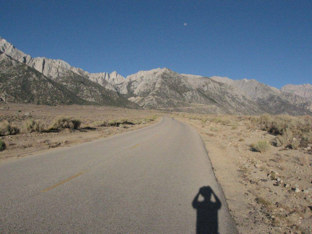
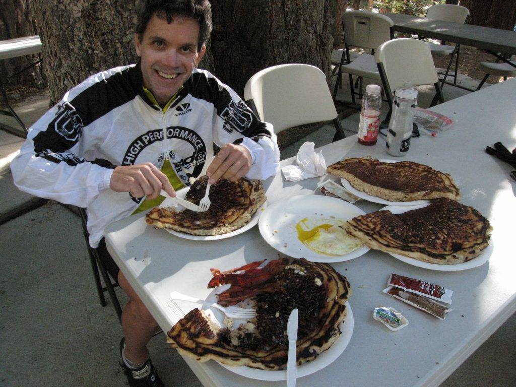
This is one of the easier climbs in the area, and relative to the other days this felt like a recovery ride. We left town early, keen on scoring a famous Whitney Portal pancake breakfast. Supposedly the altitude makes it difficult to properly cook pancakes, hence the extraordinary size. Even after the strenuous ride to breakfast, 1/2 a pancake was all I could eat.
Given this road’s popularity there are plenty of water and bathroom facilities at the trailhead area.
Independence to Onion Valley
The guidebooks call this “one of the hardest climbs in the world.” But, relative to the other climbs in the area, I would rank it below White Mtn and Horseshoe Meadows. Like most of the other rides, this one starts with ~7 miles that look flat relative to the surrounding mountains. During this “flat” section the rider experiences frustration at how difficult it is to pedal; a quick glance at the electronics show that the “flat” road is in fact a stiff 8% grade. Ouch.
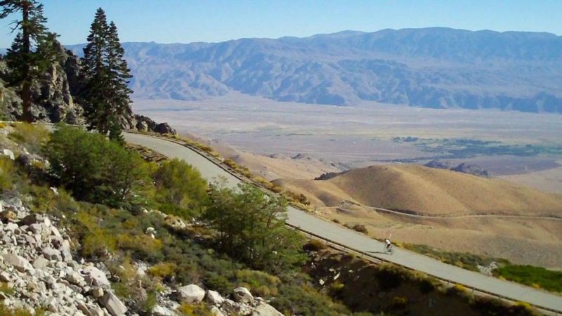
Adding to the difficulty is that most of the climb can be seen from below, with no end to the suffering in sight as you creep upwards. In a final blow to the ego, just as you are hunting for lower gears–1000m and 200m lines are painted into the roadway–which indicate the road is used in races. An oxygen-deprived brain considers this visual input: “Yowza! They race up here and I’m barely moving forward!”
Video: Whitney Portal and Onion Valley Rd.
Training
In retrospect, I didn’t prepare for this trip as seriously as I should have. The “training” I did do consisted of a century ride to Artist Point, the High Pass Challenge, and several days of hill repeats on Squak and Cougar Mts. Despite the lack of preparation, I survived ok, and found that as long as I pedaled at a steady rhythm the climbs were hard but doable. My plan was to “ride into form” which seemed to work this time around.
Off the bike, I am a fervent believer that core conditioning is essential to climbing well. I regularly attend core conditioning classes to get a group workout experience. I do core workouts on my own several days per week using a medicine ball, exercise ball, and rubber bands.
As a result of a dedication to exercising my core, and despite the difficult climbing, I only had minor tingles of lower back pain at the beginning of the rides, and zero back pain after I was warmed up.
Gear
I used a Trek 2300 with an Ultegra group consisting of a triple chainring and a 9-speed 12-27 cassette. I spent most of the time in the 30-27 granny gear. Tom and I agreed that in order to survive a week of cycling like this, maintaining a high cadence and keeping your butt in the saddle is key. If you plan to ride in this area, you would be well-advised to spend time in advance figuring out gearing that will work for you.
While the climbs were sweaty and strenuous, the finish points and the descents were downright chilly. I carried arm warmers, full-fingered gloves and a wind vest up all of the climbs and was glad to have them on the descents. On the Whitney Portal climb I brought a wind jacket instead of a vest.
Weather
We assumed that the promoters of the aforementioned Everest Challenge had done their homework on the weather. The end of September seems like the historical sweet spot for ideal weather in this region. While summer heat in the Owens Valley can reach the 110s, we experienced late afternoon temperatures in the mid-90s–well after we had finished cycling. Of course, it can snow in the high country at any time of the year. We experienced only mild winds, but the winds can howl through the Owens Valley.
I was concerned about the dry air. I typically get a bloody nose from the dryness whenever I visit the Sierra (or Colorado, or Arizona…), but somehow lucked out this time.
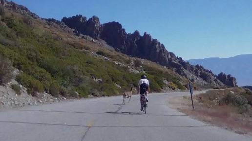
All in all, if you are looking to challenge yourself with some of the hardest bicycle climbs in the world, no need to travel to Europe, just pack up the car and head to the Owens Valley.
Updated: October 9, 2018
