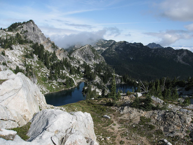
Mt. Rainer is visible from the Idaho border and from space. It’s an icon of the Pacific Northwest: 14,410’ of rock and ice rising up from the sea in an immense display of majestic beauty. Less obvious is the thin ribbon of trail circling the mountain, the Wonderland. The trail hugs the mountain’s glaciated flanks, weaves through ancient forests, flows through flower-filled meadows, and climbs the many ridges cut by Rainier’s glaciers and rivers. Ninety-three miles long and rising and falling for 21,810’, this trail is on the shortlist of the world’s most inspiring footpaths.

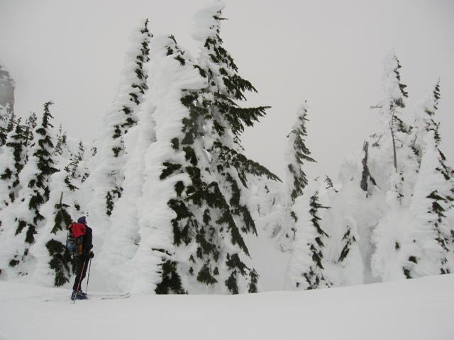
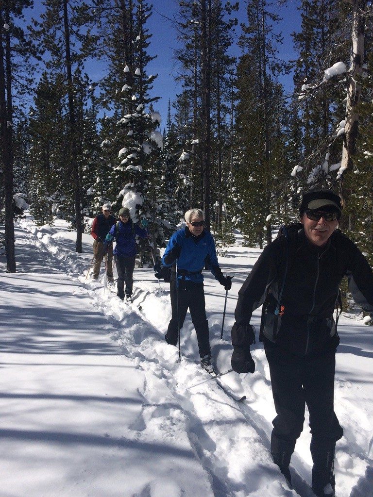
The Wonderland Trail is considered one of the world’s top backpacking destinations. Each year hundreds of pack-laden hikers spend up to 2 weeks in orbit around the mountain. Although a 2-week trip is the most popular way to do the trail, it attracts members of the ultra running community who are looking for different and faster ways to complete it.
At the fast end, two new Fastest Known Times (FKTs) were set late this summer:
Ryan Ghelfi set a new supported overall FKT of 18h 27m on September 5, 2018.
Candice Burt set a new women’s unsupported FKT of 1d 4h 45m on August 30, 2018.
That kind of strenuous pace, or for that matter, any single 93-mile push is remarkable and generally reserved for elite and/or very determined runners. However, between the extremes of a 2-week slog and a relentless sprint there is the increasingly popular supported 3-day circumnavigation. To understand what is involved, here is a primer about day one:
Longmire to Mowich Lake
34 Miles, Elevation Gain/Loss +9,755/-7,600
At the Longmire wilderness information center a well-marked “Wonderland Trail” sign is the beginning and the end of the journey. Plenty of parking is available and since this 3-day trip does not include any wilderness camping it’s considered a day hike and no permits are required. This portion of the trail is the longest and has the most remote push between campgrounds, so attacking it with fresh legs is generally favored.

Longmire to Indian Henrys
The first 5 miles of trail is the first climb of the loop. A well-groomed trail leading through old growth forests and crossings at the Kautz and Pyramid Creeks are a casual introductions to the trail. Those oriented with capturing a fast Wonderland time should be cautioned that lots of elevation and trail lie ahead. Atop the first climb is the first expansive view of the mountain at Indian Henry’s Hunting Ground.

Henrys to Tahoma Glacier
Four more big climbs and four big descents remain on day one. At the bottom of the first of these the trail crosses the Tahoma Creek via it’s iconic suspension bridge. The deep groove in this canyon made this engineering marvel possible where future crossings along wide river bottoms are relegated to sketch logs and change every year based on the shifting temperment of spring run off. The trail rises out of the trees and climbs the lateral moraine of rock deposited by the Tahoma Glacier. A deep chasm separates the rock and ice of the mountain from the trees and forests and the trail is a dividing line between what is green and alive from that which is grey and desolate.

Tahoma Glacier to Golden Lakes
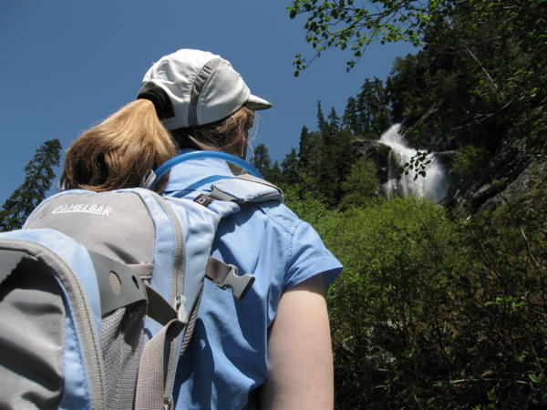
A ridgeline descent to a bridge across the Puyallup River and the third climb of the day bring one to St. Andrews Lake. On a warm weather day this is a MANDATORY swim stop. The shallow snowmelt lake is surprisingly warmer than expected and incredibly refreshing.
The trail winds through Klapatche Park with peekaboo views of Aurora Peak and Rainer in this distance. A steep descent of switchbacks, a bridge crossing at the North Puyallup River, and a solid 3 mile climb brings one to Sunset Park and a Patrol Cabin at Golden Lakes. Those interested in a leisure run will take a second swim of the day. Those motivated or intimidated by the remaining 10 miles into camp will opt to keep moving.
Golden Lakes to Mowich Lake
Six miles later, mostly descending, the South Mowich River bottom is a wide expanse of boulders and sand. If the bridges are out and the river high this crossing is one of the most dangerous sections of the entire loop. High temperatures on long sunny days can send a torrent of snow melt through surprisingly deep channels of river. If crossing without a bridge, use extreme caution. Eroding river banks, slippery footing, and large boulders crashing in the current all pose serious hazards to tired trail runners. Once across the river the a mile of river bottom trail brings runners to the base of the final climb of the day 3.2 miles and over 2,000’ of climbing are all that lie between you and camp. Eat a snack, hydrate, and send it!
Mowich Lake Campground
For the support crew the Mowich Lake campground is almost a 3-hour drive from Longmire. The last 15 miles are on a dirt, gravel, washboard section of road leading to one of the park’s most remote entrances. Camping here is first-come first-served, walk-in only (look for the wheelbarrow to shlep gear), and there is no potable water. Despite or because of the limited amenities this campground is a little slice of heaven. For runners replenishing the body after a long day one is essential to doing it all over again the next day. Good food, a warm shower, and a thick sleeping pad can reboot the system for stage 2.

Read more:
Part two: Mowich Lake to White River
Part three: White River to Longmire
Sponsored by:
Aspire Adventure Running organizes single and multi-day running adventures in wilderness terrain across Cascadia. They provide logistical and emergency support paired with delicious meals and community for a unique and memorable backcountry running experience. In partnership with Mt. Rainier National Park they organize supported runs on the Wonderland trail. Check out their website for 2019 dates!